imma dork
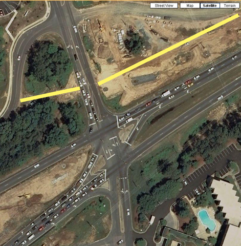
I noticed today, driving to (UNC) campus that the intersection at 15-501 and Erwin had finally gotten an overhaul - it was such a horrible intersection. Thank god for Google Maps for providing satellite views. The original intersection looked something like:

(I had to draw in the yellow lines which were the old roads used to be, and Google Maps doesn't have historical views)
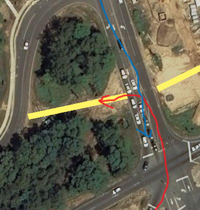
The problem with the old intersection was the following:

Since blue line had right of way, red cars would inevitably get stuck. And somebody would always be blocking that intersection, so cars would get backed up into the intersection. A few years back, they moved the service road on the left side back - then they moved the one on the right back.
So when I last visited, the intersection still looked like this:

I thought I had heard they were gonna turn the whole intersection into a giant roundabout, like the one at the other end of Erwin:

I was excited about this after my road trip to Massachusetts a few years back, when I got to experience the first-hand benefits of a roundabout at a busy intersection in Cape Code.
Much to my surprise today, it wasn't an 'true' roundabout, but a Michigan left.
Under circumstances I don't remember, I remember reading about the Michigan left on Wikipedia a few months ago ... finally! Useless knowledge coming to my rescue... I felt pretty badass that I knew what it was called. (And I hope it's actually a Michigan left, cause I'd be embarassed if it wasn't).
When Google Maps updates their satellite pictures, I'll post them to this entry.
(And if you're wondering what I do with my spare time, now you know).


Comment with Facebook
Want to comment with Tabulas?. Please login.
Allen
